Fichiér:Philippines relief location map (Mindanao).svg

Talye de cél apèrçu PNG du fichiér SVG : 656 × 486 pixèls. Ôtres rèsolucions : 320 × 237 pixèls | 640 × 474 pixèls | 1 024 × 759 pixèls | 1 280 × 948 pixèls | 2 560 × 1 897 pixèls.
Fichiér d’origina (Fichiér SVG, nominalament 656 × 486 pixèls, talye du fichiér : 2,21 Mio)
.svg)
Dèscripcion
| Dèscripcion |
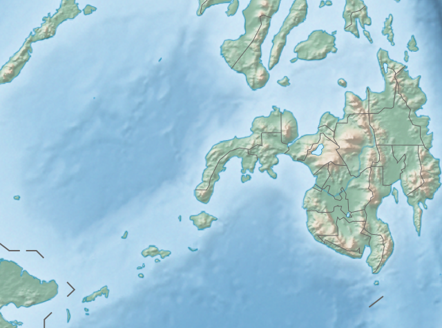
English: Physical location map of the Philippines (Mindanao)
Equirectangular projection based on the parallel of 10°43' N
|
| Dâta | |
| Sôrsa | File:Philippines location map (square).svg |
| Ôtor | User:Hellerick |
| Ôtres vèrsions |
Ce fichier est dérivé de : Philippines relief location map (square).svg: .svg) |
.svg)
Licence
Cél fichiér est disponiblo desot la licence Creative Commons atribucion-partâjo du-mémo 3.0 pas transposâye.
- Vos éte libro :
- de partagiér – de copiyér, distribuar et tramandar l’ôvra
- d’adobar – de changiér l’ôvra
- Desot cetes condicions :
- atribucion – Vos dête balyér les enformacions que vant avouéc regardent l’ôtor, fornir un lim de vers la licence et pués endicar se des changements sont étâs fêts. Vos pouede cen fâre per tot moyen rêsonâblo, mas en pouent de façon que balye l’idê que l’ôtor vos sotint ou ben aprôve l’usâjo que vos en fêts.
- partâjo du-mémo – Se vos changiéd, transformâd, ou ben vos apoyéd dessus cel’ôvra, vos dête distribuar voutra contribucion desot la méma licence ou ben na licence compatibla avouéc cela de l’originâl.
Historico du fichiér
Cllicar dessus na dâta et hora por vêre lo fichiér coment il ére que.
| Dâta et hora | Miniatura | Dimensions | Utilisator | Comentèro | |
|---|---|---|---|---|---|
| d’ora | 27 octobro 2017 a 14:36 | | 656 × 486 (2,21 Mio) | Mliu92 | Updated crop to add missing island. |
| 26 octobro 2017 a 17:23 |  | 573 × 573 (2,21 Mio) | Mliu92 | User created page with UploadWizard |
Usâjo du fichiér
Gins de pâge emplèye cél fichiér.
Usâjo gllobâl du fichiér
Cetos ôtros vouiquis emplèyont cél fichiér :
- Usâjo dessus bcl.wikipedia.org
- Usâjo dessus bn.wikipedia.org
- Usâjo dessus en.wikipedia.org
- Sulu Sea
- Moro Gulf
- Mount Apo
- Davao Gulf
- Iligan Bay
- Panguil Bay
- Bud Dajo
- Mount Butung
- Agusan River
- Lake Lanao
- Rio Grande de Mindanao
- Butuan Bay
- Mount Agad-Agad
- Mount Hibok-Hibok
- Mount Makaturing
- Mount Matutum
- Musuan Peak
- Agus River
- Sibuguey Bay
- Illana Bay
- Mount Sumagaya
- Dinagat Island
- Davao River
- Leonard Kniaseff
- Mount Kitanglad
- Macajalar Bay
- Pulangi River
- Cagayan River (Mindanao)
- Mount Dulang-dulang
- Tagoloan River
- Lake Buluan
- Lake Wood (Philippines)
- Lake Dapao
- Mount Malindang
- Mount Kalatungan
- Latukan
- Mount Balatukan
- Mount Hamiguitan
- Mount Baya
- Agusan Marsh Wildlife Sanctuary
- Camp General Basilio Navarro
- 2010 Mindanao earthquakes
- Manupali River
Vêre l’usâjo gllobâl de cél fichiér.
.svg)
.svg)